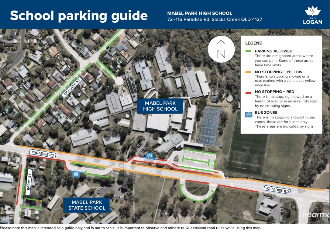
School Map
The school map is available on the right hand side.
Transport
The Translink public bus stops on the opposite side of Paradise Road outside the Primary School. The bus does not stop on the High School side of the road.
For the safety of the students, there is a bridge that goes over the top of Paradise Road from the Primary School side of Paradise Road to the High School side.
This is locally known as the 'Learning Link Bridge'.
Parking at school safely
Nobody likes a parking fine. For helpful tips on where to park safely around our school, please click on this link - Parking at schools guide.
In addition, check on the map below to see where you can and cannot park when visiting our school.